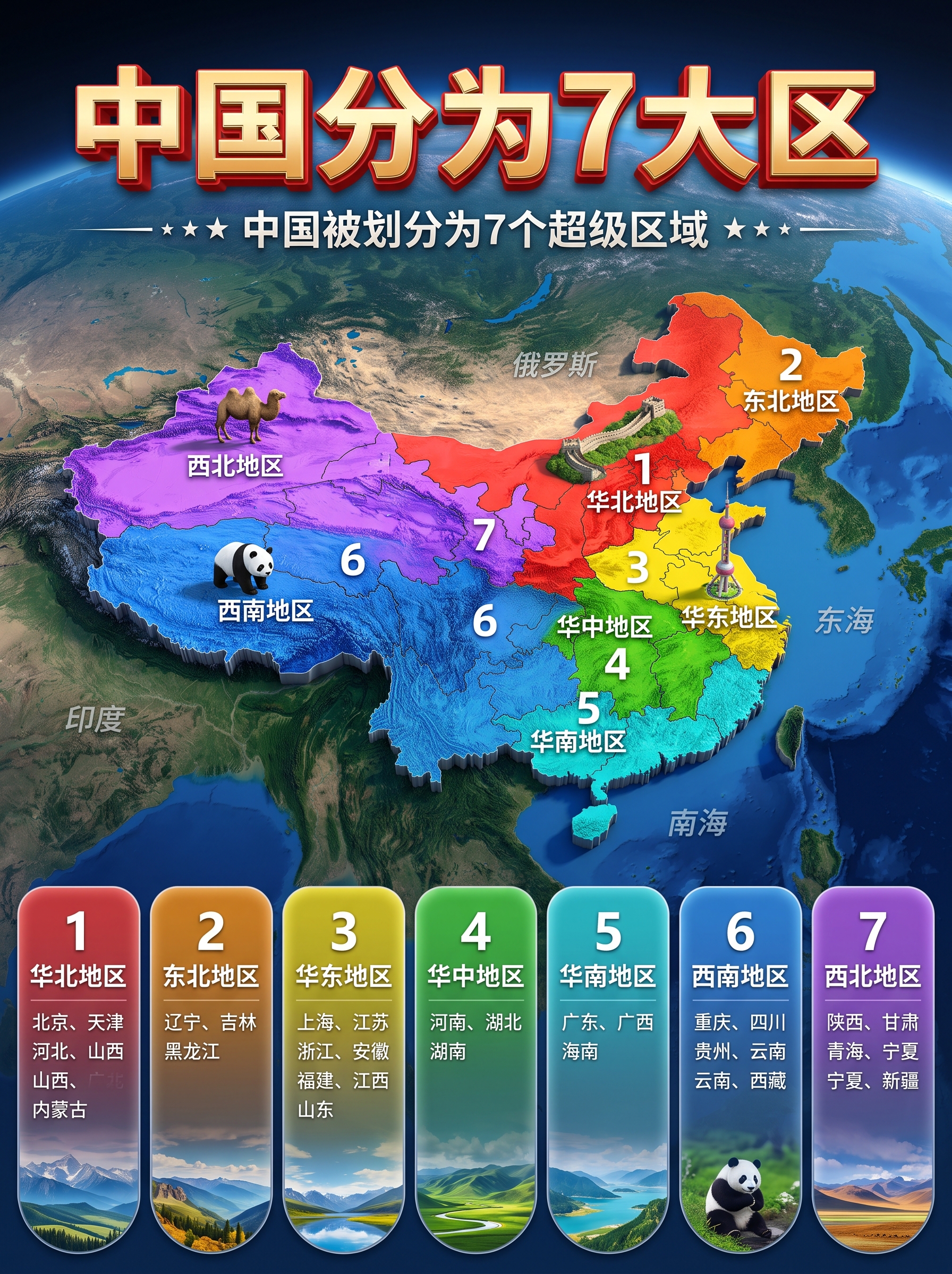
Viral One-Click Region Map
Turn any place into a 3D region poster
Viral One-Click Region Map
Turn any place into a 3D region poster
Showcase
Description
Ideal for geography explainers, travel guides, hometown introductions, short-video covers, and viral image posts that grow followers. Enter any place name—a country, province, city, county, or town—and automatically generate a 3D relief-map-style “Super Regions” poster with a satellite Earth background, a colorful regional map, distinctive landscape illustrations for each region, and a region list card at the bottom. Everything is in Simplified Chinese.
Best for
Creating visual content for geography explainers, travel guides, hometown introductions, and short-video covers.
How to use this Skill
Provide your input
Enter a place name, optionally with the number of regions.
Run the Skill
Verify the place’s administrative divisions and geographic features, combine related units into multiple super regions, and create an informational poster.
Review your result
Create a vertical 3D map poster with a title, colorful regions, landscape illustrations, and a region list card, all in Simplified Chinese.
Related Skills
View all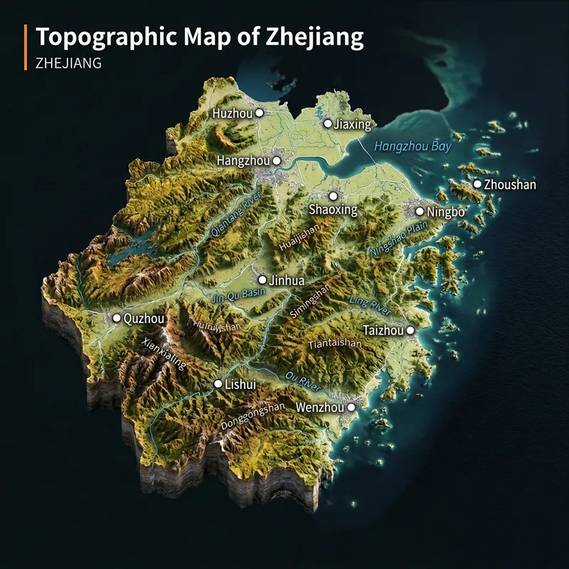 Image
ImageViral 3D Terrain Map Maker
Real Terrain Map Generator. Ideal for growing a new account, with high engagement. Enter any place name to instantly generate a realistic 3D terrain diorama. Provinces, cities, counties, townships, and villages are all supported, as long as they can be found on a map. The map is cropped to actual administrative boundaries, with mountains, plains, rivers, and coastlines based strictly on real geography. Real place names are labeled, with no made-up details.
 Image
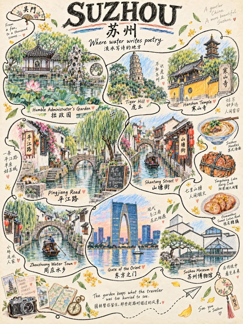
ImageOne-Line Travel Poster
Anything can be illustrated: countries, provinces, cities, counties, towns, and villages are all supported. The system automatically identifies the geographic level—choosing landmarks for larger places and capturing the character of everyday life in smaller ones. ✏️ Authentic hand-drawn feel: colored pencils and crayons, with visible paper texture, pencil strokes, and naturally unsteady linework 🔍 Details worth discovering: hidden cats, birds, postcards, tickets, and other small surprises that reveal themselves when you zoom in 🔤 Bilingual title: English + Simplified Chinese by default, with customizable languages 📐 Default 3:4 portrait format: ready for Xiaohongshu and Douyin covers, phone wallpapers, and printed decorative art 🎨 Magazine-style layout: an ivory-beige paper background with a handwritten tagline, suitable for sharing on social media, tourism promotion, and travel check-ins Who it's for: Travel bloggers, tourism promotion, social media covers, hometown promotion, birthday or anniversary gifts, and decorative art design.
 Image
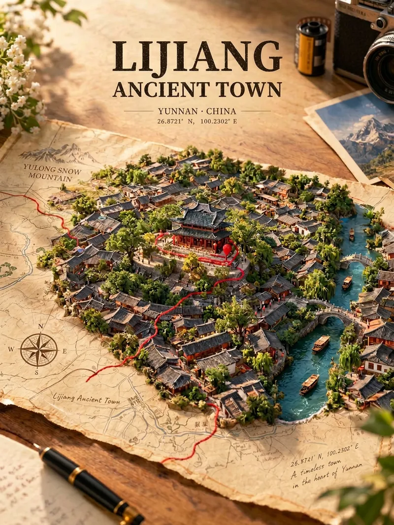
ImageMap Treasure Poster
For travel, geography, history, and urban culture creators; creators making carousel graphics and short-video covers; and account operators who want to produce images in batches at low cost. Enter any place in the world—from a country or city to a town or village—and generate a creative poster showing the city breaking through paper. Real streets, rivers, and iconic buildings slowly rise from a yellowed vintage map, while a red line winds along actual streets before wrapping around the landmark. Landmarks, architectural styles, terrain, waterways, and coordinates are all recreated according to the real location, with no random drawing or mix-ups. The default format is a 3:4 portrait layout, with bilingual Chinese-English poster text. The aspect ratio and language can be customized.
Information
- Version
- v4
- Last updated
- Runtime credits
- Usage-based
- Models
- Auto
- Use cases
- Images & designLearning & educationMarketing & growth
- What you get
- Image
- Visual styles
- 3DPlayfulPhotorealistic