
City Miniature Relief Art
Turn a city into a world within one brushstroke
City Miniature Relief Art
Turn a city into a world within one brushstroke
Showcase
Description
Fit a city into a single brushstroke. Enter a city name, and let its landmarks, gardens, waterways, or modern architecture unfold along the brush tip to form a detailed miniature relief artwork on a white background with generous negative space. It’s ideal for city-themed posters and travel keepsakes, or for exploring a familiar city in a new way. Before generating the image, xiaoxiaodong first organizes the landmarks and visual plan for you. After you confirm which scenery to keep, generation begins. You can specify landmarks, classical or modern styles, landscape or portrait orientation, and preferences such as no text or no visible hand. To skip a step, say “choose everything and generate directly.” If you only want to develop the concept for now, you can choose to organize the prompt only.
Recommended by
Dancang
Why we love this skill
Weaves city landmarks into one continuous brushstroke, combining landmark research, composition review, and final-image checks for a recognizable city scene with the spirit of Chinese calligraphy.
Best for
Content creators and travel enthusiasts making city-themed posters, travel mementos, or exploring new ways to express a city visually.
How to use this Skill
Provide your input
Enter a city name. You can also specify landmarks, a classical or modern style, orientation, season and lighting, a signature, and whether to show a hand. You may ask for automatic scene selection or prompts only.
Run the Skill
The system organizes city landmarks and a composition plan for your confirmation before generating. If you choose automatic generation, it selects a suitable scene and layout directly.
Review your result
Receive a white-background miniature relief artwork where city landmarks follow a continuous brushstroke curve, or a complete prompt for generating the image.
Related Skills
View allCity Landmark Diorama
Turn a city’s representative landmarks into a miniature map illustration that combines geographic grounding with visual appeal. Simply provide the city name along with any preferences for coverage, language, scale, or style. The Skill will organize the relative positions of around 5–8 key landmarks, riverbank relationships, roads, bridges, and distances between landmarks, while shaping the scene around local architectural character. The final result is a complete, ready-to-view city landmark diorama—not just a prompt or composition plan. The scene uses a full-frame warm-toned map surface, refined, colorful 3D diorama models, a small and varied selection of background buildings, and clear Chinese labels to emphasize the visual hierarchy of “large landmarks, small buildings.” It also retains a city title plaque in the upper left, a north arrow in the upper right, and necessary artistic annotations. This makes it suitable for city introductions, travel and cultural content, regional overviews, and visual presentations. After generation, it also checks landmark recognizability, relative positions, river and road relationships, label text, and compositional consistency, making corrections when needed. This is an artistic illustration of city locations and does not replace navigation, surveying, or a map with a precise scale. When web research and image-generation capabilities are available, it can include brief sources, the research date, and reusable prompts. If image generation is not currently available, it provides a complete image-generation prompt and a location list.
Viral Place Miniature Maps
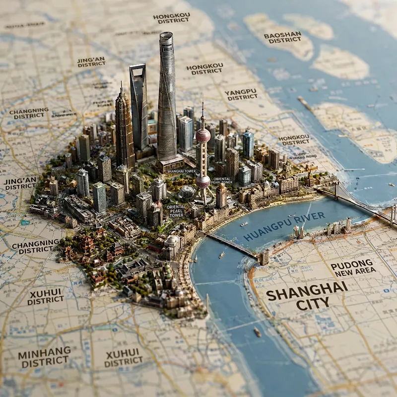
Enter the name of a city, district, county, township, province, country, or region to generate a realistic miniature map city and landmark image. Based on the area’s real geography, the image combines map features such as terrain, coastlines, mountains, rivers, and roads, bringing representative architecture, natural landscapes, city skylines, and regional cultural elements to life in their corresponding locations. The result naturally blends a map with a miniature diorama. The default format is a 1:1 square composition from a top-down perspective, with the shallow depth of field of high-end macro photography, finely detailed materials, soft lighting, and the collectible quality of a scale model. You can also add requests for a night scene, snowy setting, specific color palette, camera position, or landmarks. After generation, the image includes a brief explanation of the representative elements shown, making it suitable for travel visuals, city showcases, regional cultural expression, and geography-themed creative work.
 Image
ImageCity Architecture Passport
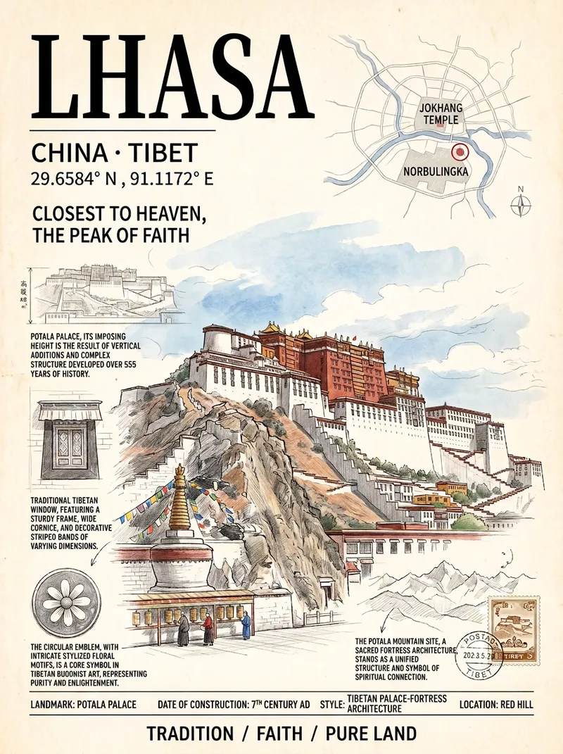
Ideal for travel posts, creative merchandise, social media covers, and home decor. Just enter a city name to automatically select its most representative landmark and generate a vertical travel poster in an “architecture passport” style: the main building is delicately rendered in colored pencil and watercolor, surrounded by a subtle city map, architectural survey drawings, detail close-ups, latitude and longitude, and handwritten annotations. It features an ivory paper texture and an upscale magazine-cover layout. All text in the image is in Simplified Chinese. The default aspect ratio is 3:4, and a custom ratio can be specified.
Information
- Version
- v3
- Last updated
- Runtime credits
- Usage-based
- Models
- Auto
- Use cases
- Images & designMarketing & growthLifestyle & entertainment
- What you get
- ImagePrompt
- Visual styles
- 3DInk washTraditional Chinese